


A pleasant week on the way to the coast as temperatures return to near to slightly above average values following a stretch of cooler weather. Some rain will cause problems by midweek.
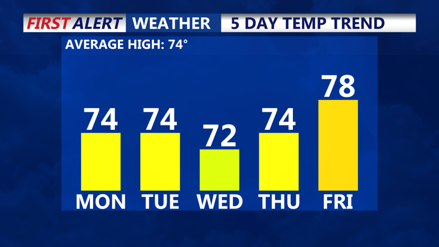
Temperatures are starting out on the chilly side this morning, down into the 40s. Today, as a whole, will be quite pleasant with temperatures climbing into the low to mid 70s inland and the mid 60s at the beaches. Sunshine is expected all day on Monday.
Clouds will return to the region on Tuesday afternoon, but sunshine is expected early on. Temperatures will rise into the mid 70s. Some rain showers are expected to arrive on Delmarva Tuesday evening. Those rain showers will intensify overnight.
The heaviest rain is expected on Wednesday as an area of low pressure swings through. There will likely be two rounds of rain on Wednesday, one early in the morning and another during the afternoon hours. Rainfall totals could approach an inch on Wednesday.
Drier weather returns for the second half of the week before more rain could return to the coast next weekend. For your full First Alert Weather forecast, be sure to tune into CoastTV News Today.